Utah Trip—Spring 2017
So, we’re all returned from a fabulous 8-day trek around the southern Utah parks and monuments, and I’m going to do a blow-by-blow write up along with photos and maps. Let me thank Rick Decker up front for organizing the trip, as well as being a great traveling companion. And Kendall Gelner as well, who joined us in Utah and brought along his wife’s Jeep Cherokee to help shuttle us into areas that would have been relatively inaccessible by car (although mountain bikes would have been great!).
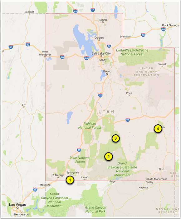
Rick and I flew into Las Vegas and met at the car rental area. We grabbed a car, headed to a local Starbucks, and then went over a couple of different itineraries that Rick had written up. One thing I want to mention is how great it is to have a guide with local knowledge. Rick was driving around this entire area like it was his backyard (knowing stores, coffee shops, etc)—and he’s from Hawaii. He does come out west often though, and it shows with his ability to navigate pretty much anywhere we needed to go. So—the itineraries were ambitious, and had us starting out at Death Valley and areas west shooting some dunes (which is awesome). Sadly for us, the southern California deserts are in beautiful bloom this year, and we couldn’t get a room. This pretty much destroyed the itineraries, so we began to improvise immediately. We decided on spending a day or two (or three, as it ended up) in Zion, and we would work our way to Moab to meet Kendall on Sunday. We had no reservations, so we’d play it by ear as we ambled from town to town.
Utah Trip—Camera Notes
So, one of my goals on this trip was to get to know my new Sigma sd Quattro camera. I had taken it out to the beach last summer and had gotten some nice shots, but I didn’t do any hardcore landscape work (I preferred to float on the water). Starting out this trip, I was shooting mainly handheld, and using ‘normal’ exposure techniques. I was manually focusing most of the lenses without the magnification aid. By the end of the trip many of the shots were on a tripod, I was using the SFD mode of the camera—which takes seven consecutive exposures bracketed by a stop of exposure, and I was making good use of the focus magnification to focus the lenses.
Speaking of lenses, I brought the following:
10-20 mm (older version, f4-f5.6)
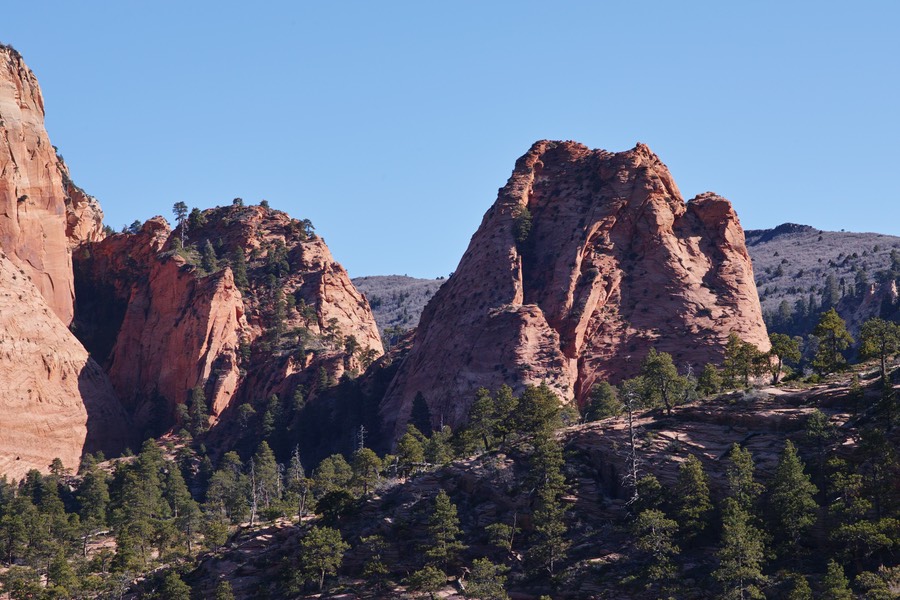
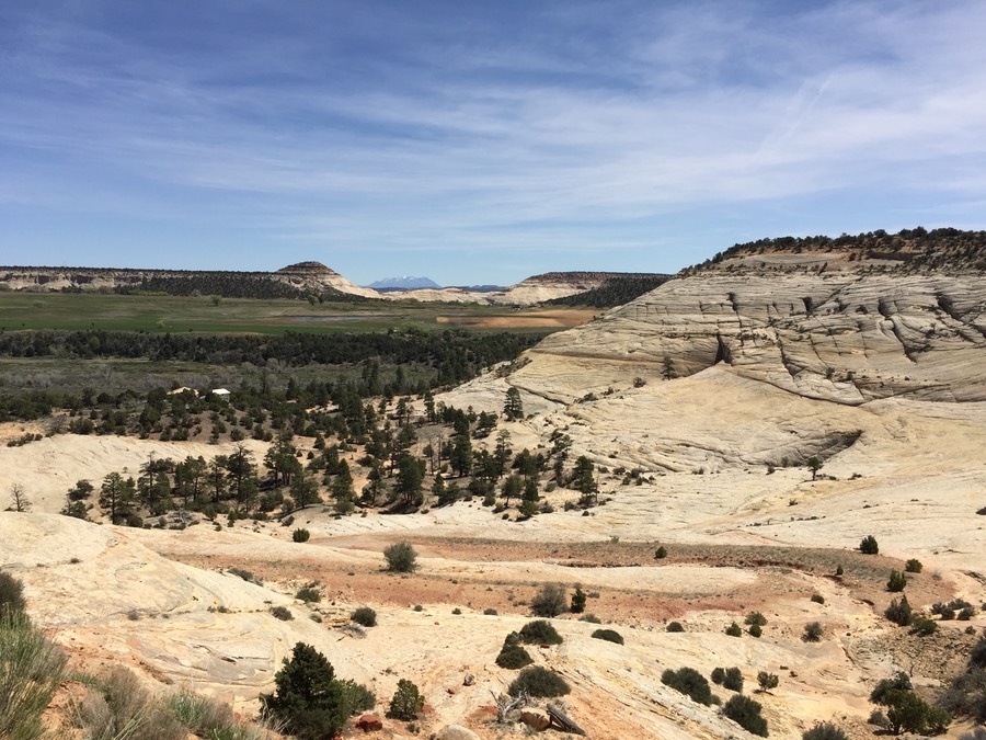
Utah Trip–Tuesday Afternoon, Kolob Canyon and Kolob Terrace Road
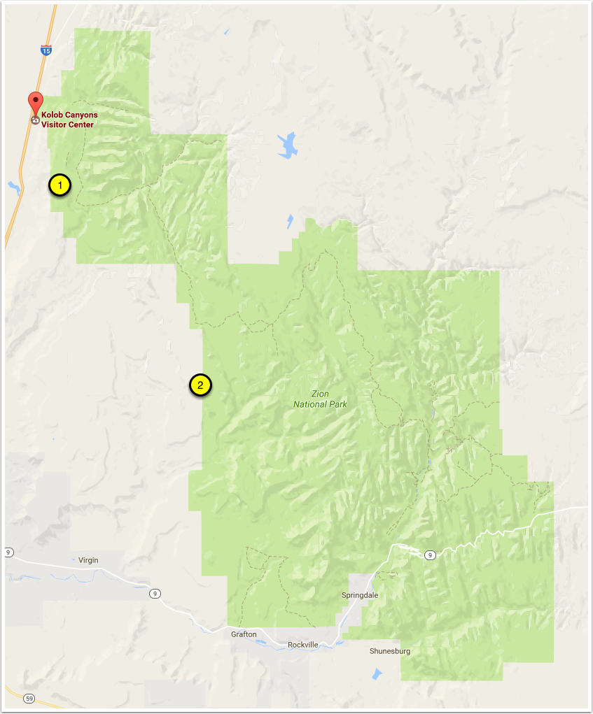
So, as I mentioned in the previous post, there was no rooms in Death Valley for us to do Rick’s itinerary. We made our way from Las Vegas to Zion, and after a brief delay of overshooting the turn (I was driving…), we headed into our first destination for the afternoon, the Kolob Canyon Visitor Center (1).. This was my first time here. Rick and I had done a bit of shooting in Zion in 2010, but it was off of route 9 on the way to Bryce. We got in around 1:30 pm, so clearly the sun was going to be challenging for creating keepers; however, we did have a bunch of puffy-fluffy clouds (the non-technical term for cumulus) that would give us some nice light.
The parking lot at Kolob Canyons. See the beautiful sandstone in the background.
Utah Trip–Wednesday Morning, Kolob Terrace Road
So, after a good nights rest and a bite to eat at Cafe Sol in Springdale, we headed out to do some more exploring. Rick decided to drive along Kolob Terrace Road again, going a few miles north of where we were the previous afternoon. We explored a dirt road (1) that went into a cool valley, but there were eventually gates and private property signs. We got out and looked around, but didn’t go any farther.
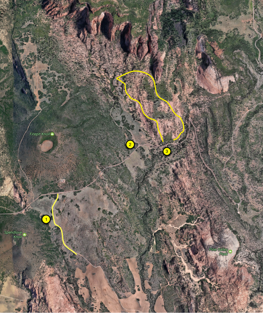
But from another dirt road (with another gate, 2), we decided to take a few shots of the surrounding countryside. This is a cool area, basically south of Kolob Canyon and north of all the ‘usual’ part of Zion that people visit. A nice combination of some forest and sandstone.
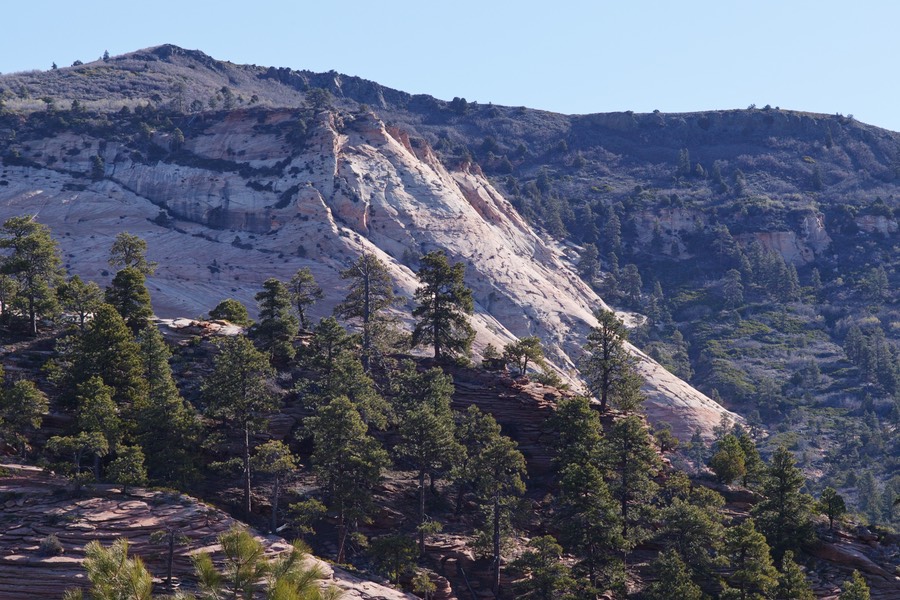
From (2) we jumped back into the car and starting driving up the road. A little way later, I saw an area that had some water on the side of the road with some nice open forest area, so Rick stopped the car at (3), and we started to explore the area.
Utah Trip–Wednesday Afternoon, Kolob Reservoir, Northgate
So, Wednesday afternoon became an afternoon of exploration, getting lost, some massive milage (we did over 10 miles of hiking on Wednesday), great sites, and comparatively little photography. We started by driving from our last hiking spot (1) up Kolob Terrace Road towards the Kolob reservoir. It was some really interesting scenery, and as we got higher into it, there was still quite a bit of snow (!) up in the area. At the reservoir itself (2), we found a few groups of fishermen who were donning wetsuits, waders, and other warm gear to brave the trout fishing. Apparently this is a trophy lake for trout! There was a road closed sign going around the east side of the reservoir, but that didn’t stop us from blasting through the mud and gravel to try to make our way to some roads that Rick knew. However, the big pile of snow (at 2) did—we turned around and headed back. The good news was that the mud on the road left the Nissan covered with a layer of bad-ass mud; we kept this on the vehicle until our last day in Moab.
Utah Trip–Thursday, Zion
So Rick had been real easy on me so far this trip. No super early sunrises. Being in a valley helps too, the sun doesn’t get up over the sides for a while. This morning, we decided to do a classic sunrise shoot; the cliffs behind the Zion Human History Museum. That’s (1) on the map, and it’s just a mile into the park from Springdale. This was going to be our last full day in Zion, so we wanted to make sure we got our money’s worth.
The pre-sunrise light puts some nice colors on these rocks. It was pretty windy and cool this morning, and that probably helped to cut down the number of photographers at this popular spot. This was also my first attempts at using the SFD mode on the sd Quattro—it takes six exposures in rapid succession, followed by a 7th (wait for it!). These are all bracketed by 1 stop around whatever your base exposure setting is.
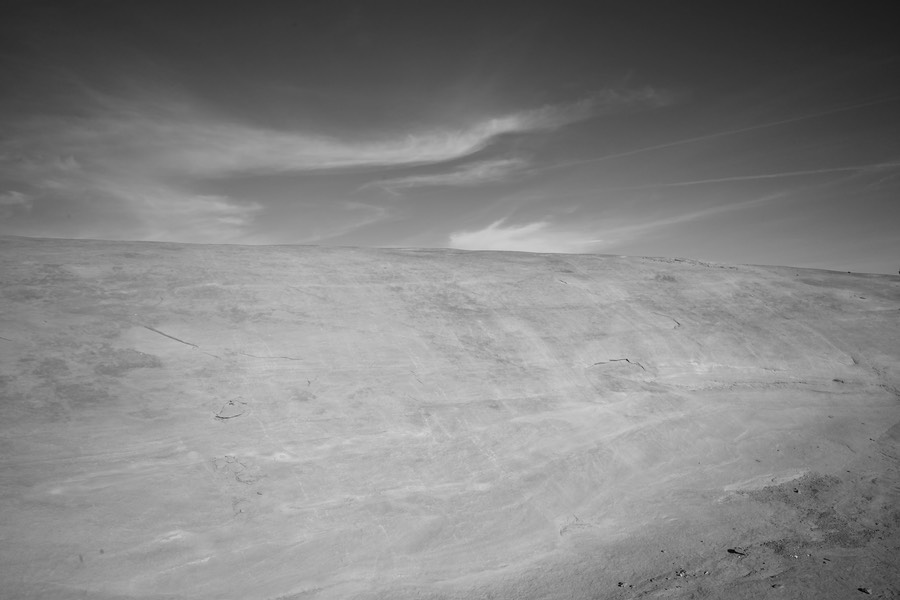
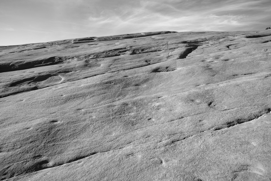
Utah Trip–Friday Morning, Zion
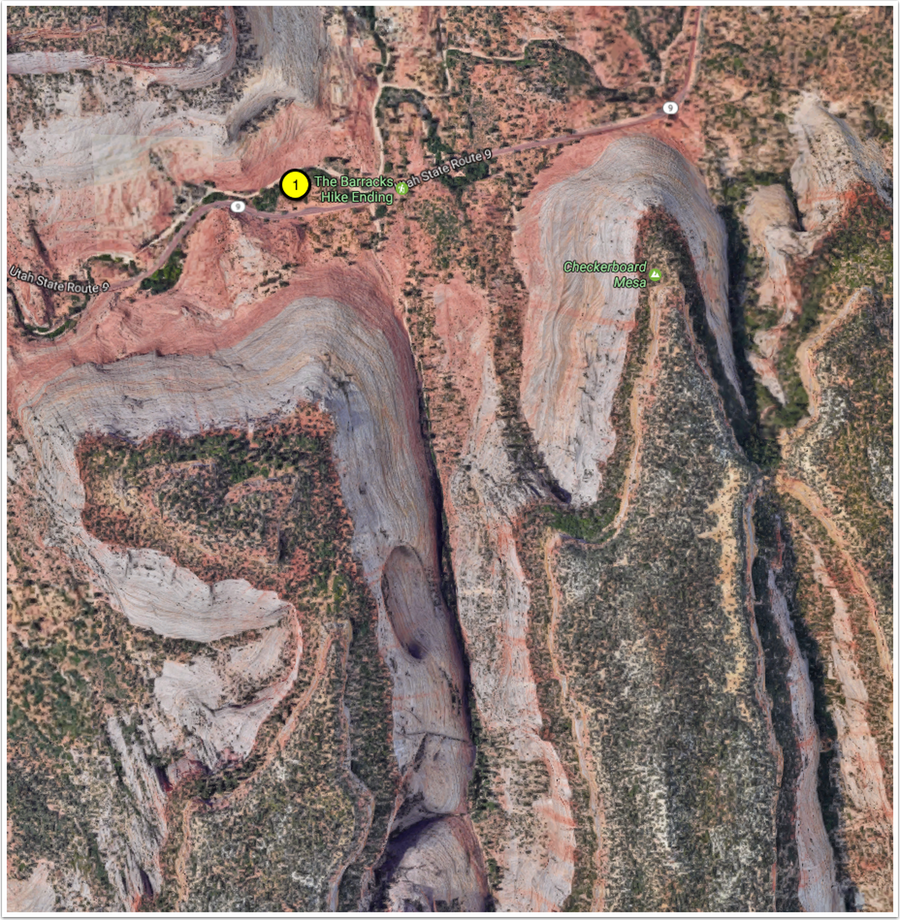
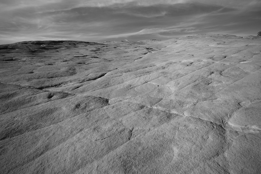
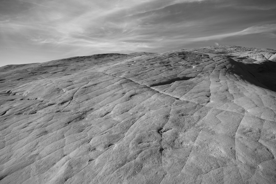
Oh no—it’s Friday, and this is our last day at Zion! No more luxurious cabins, no more Cafe del Soleil, no more Sol Foods!! It’s been an incredible three days in this area—made more so because this really wasn’t on the initial plan. Sometimes it’s best to just show up, and make the best of the environment and the light! So, Rick’s plan this morning was to head east out of the park, and stop for a while at a spot he knew near Checkerboard Mesa. Checkerboard Mesa and the unnamed mesa next to it are impressive sandstone formations; 900’ tall, and striated in all sorts of interesting ways. We parked at (1) below, crossed the road, and headed a bit west to shoot the sandstone flats.
The walk in. Have I mentioned how fantastic these rocks are?
Utah Trip–Friday Afternoon, Devil’s Garden in color
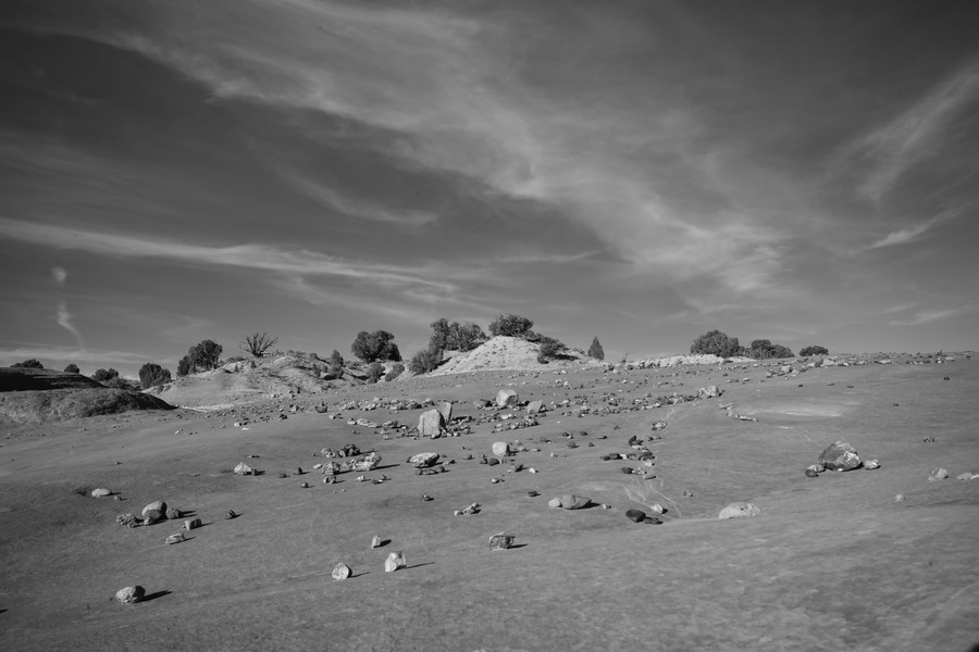
It was time to jump in the Rogue and drive to Escalante. Starting in the lower left of the map, we continued on 9, hung a left at 89, and then a right at 12. We went through Bryce with no stop, and continued on this scenic drive until we hit our destination in Escalante. I can’t remember the name of the hotel, but we got rooms, T-shirts, and then made a plan to head to Devil’s garden.
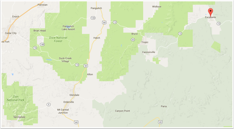
Devil’s Garden (1) is southeast of town, along a well groomed gravel road (probably about 10 miles in). Apparently there are many dirt roads out here that are fabulously secluded and super dangerous during winter and when it rains—but potentially worth some exploration on another trip. Also, there are lots of dinosaur bones and tracks in this general area—of course, we weren’t on the lookout for these.
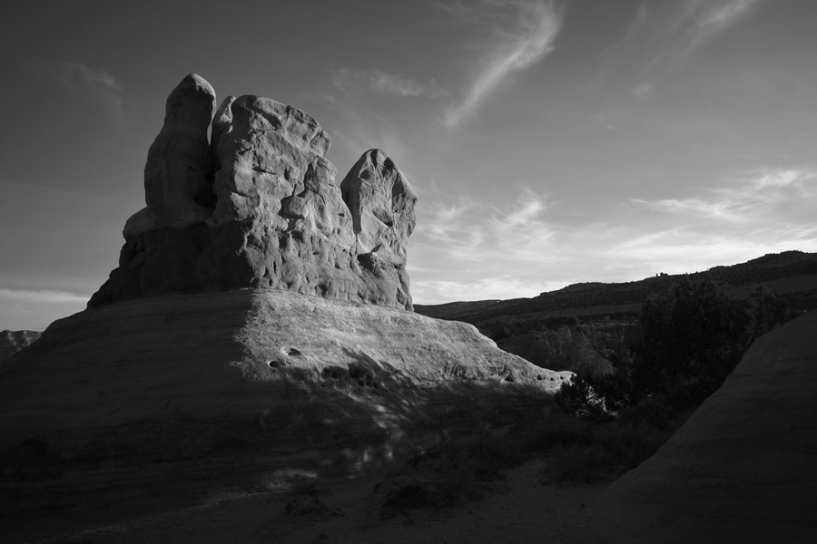
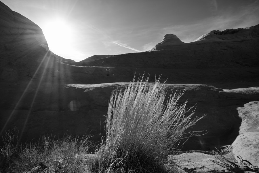
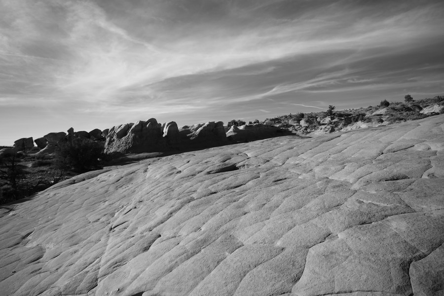
Utah Trip–Friday Afternoon, Devil’s Garden in B/W
The pallet for Devil’s garden is really wonderful; blue sky and orange/brown rocks. But it also shines when you take the color out…
Now, I’ve found for my blogging software, if I don’t put enough words in the opening paragraphs, the ‘shortened’ version of the post ends up including all the images, which is not what I was hoping for. If I only would learn a bit more html and css, I could write these things entirely by hand! Let me know what you think of the B/W versions versus the color ones—I’m thinking of printing a series of these, and I’m tempted to do the B/W.
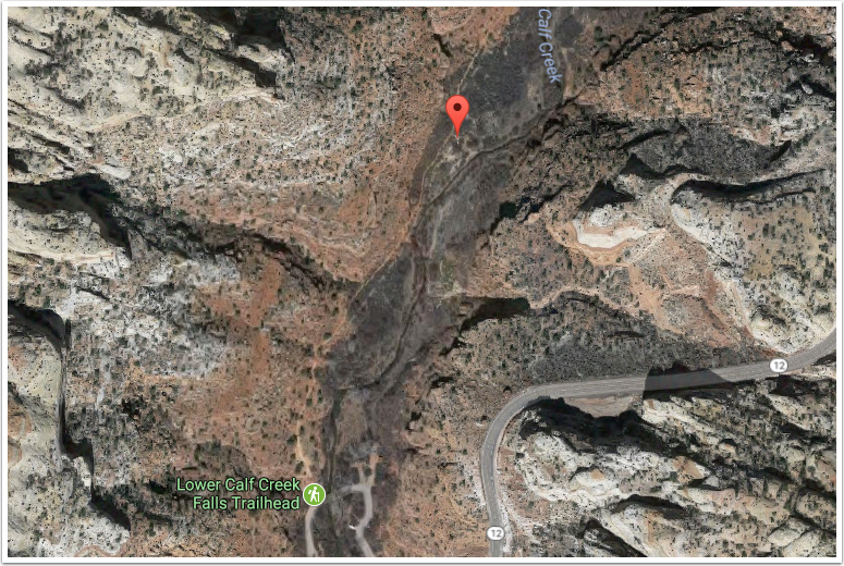
Utah Trip–Saturday Morning, Lower Calf Creek Falls
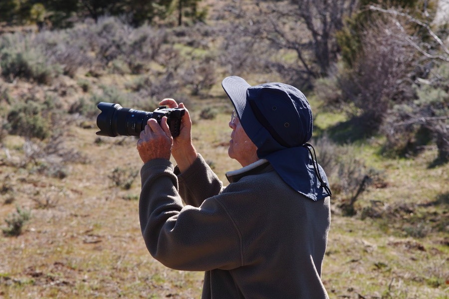
Up bright and early on a very crisp Saturday morning. Temperatures in the upper 30’s. We were heading to Lower Calf Creek Falls, a park in the Grand Staircase Escalante area. The hike to the lower falls is about 6 miles round trip, but the path is through a valley with only moderate hills. It was really a beautiful morning—we knew it was going to get hot during the day, so we had shorts and jackets for the trip out.
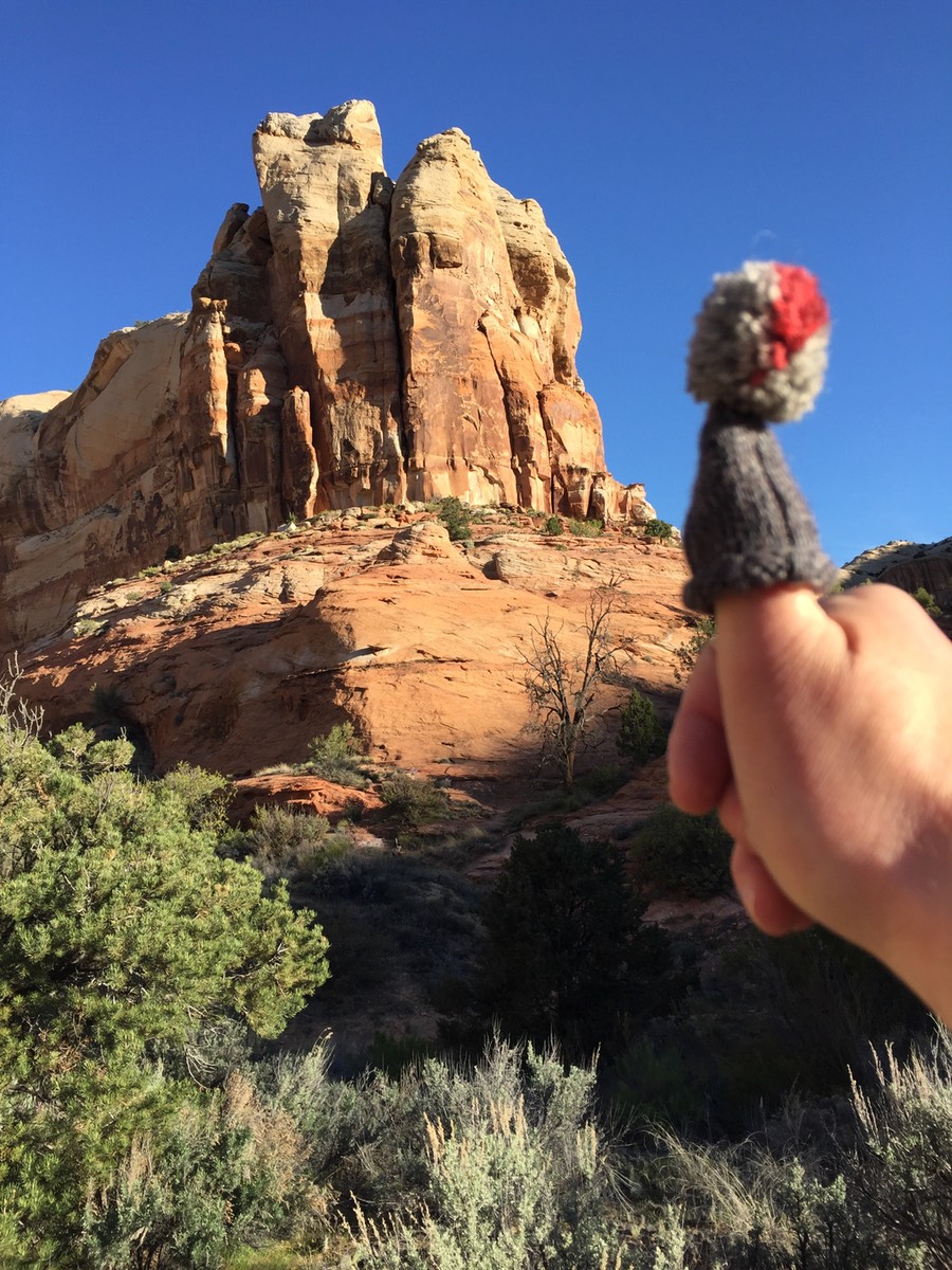
Chilly morning? Thumb hat on!
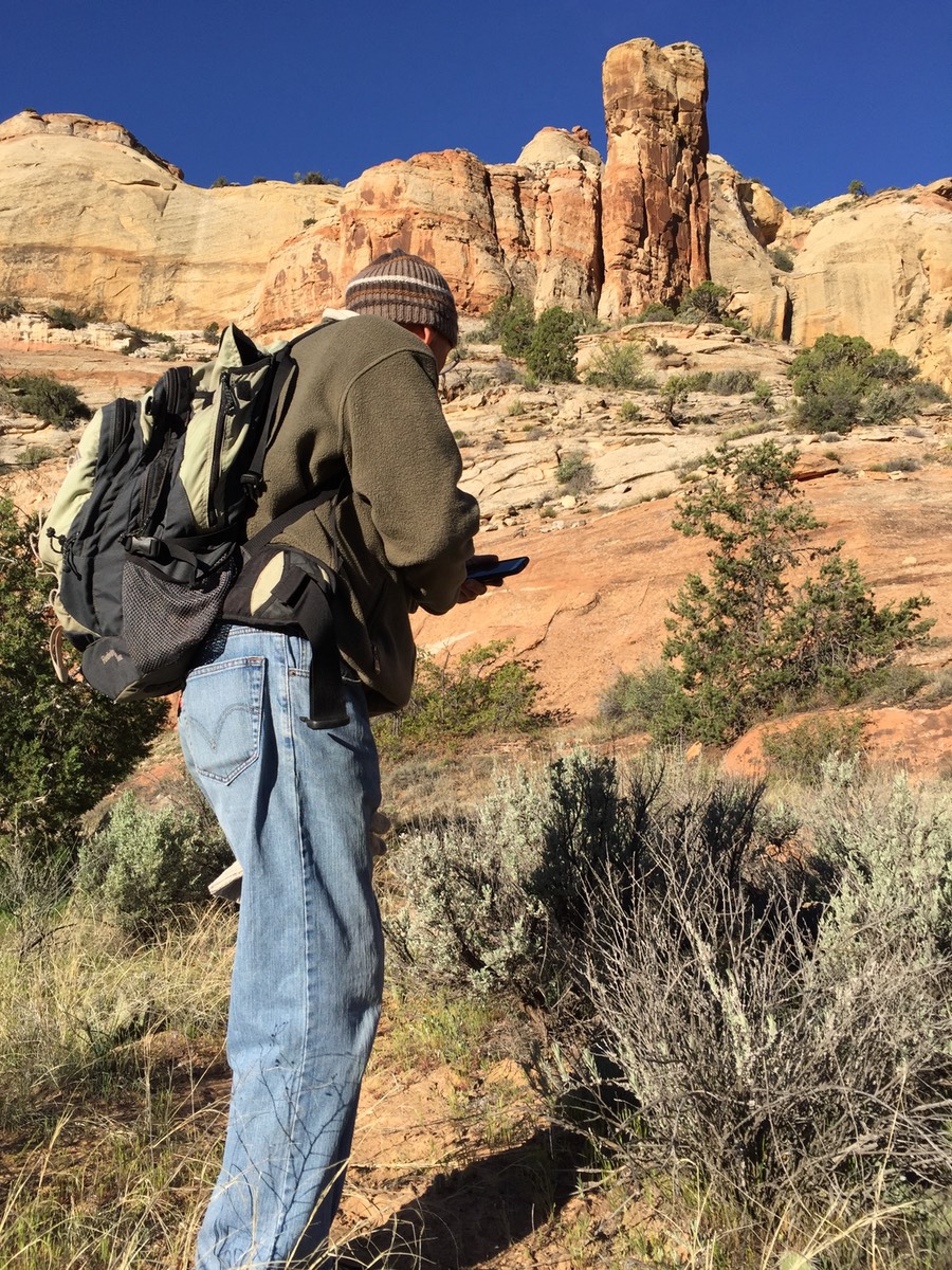
Rick is checking out the trail…
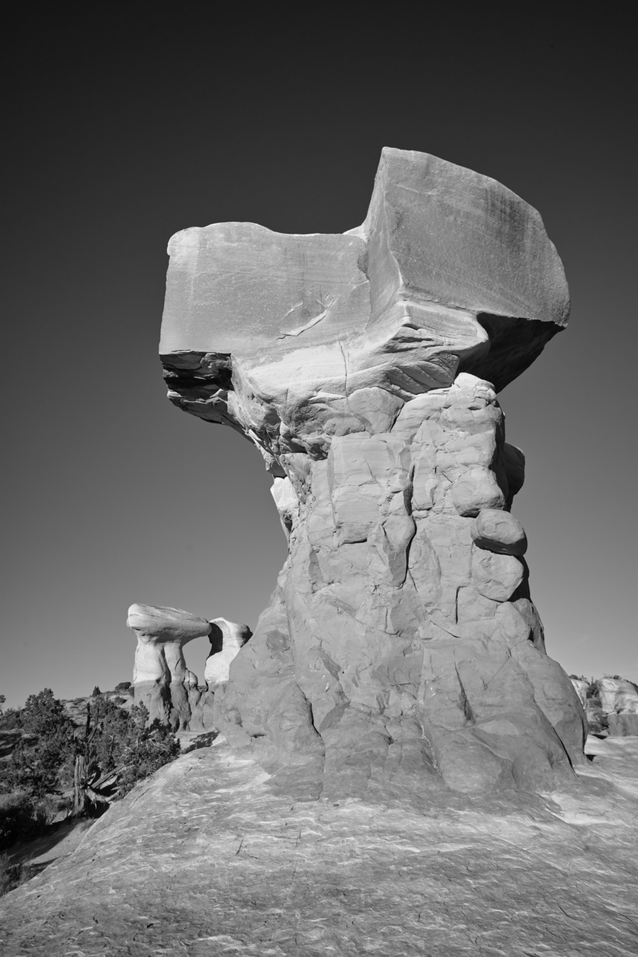
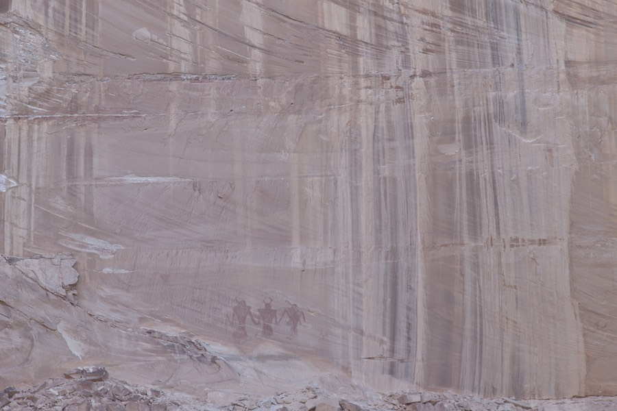
Of course, the first thing we’d encounter on this hike were these oldsters. This was shot with a long lens across the creek bottom.
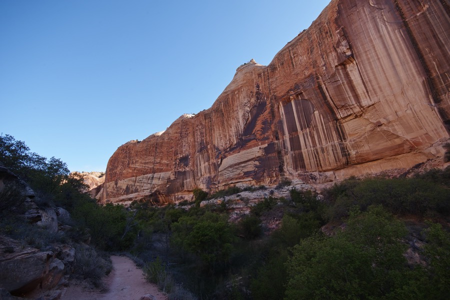
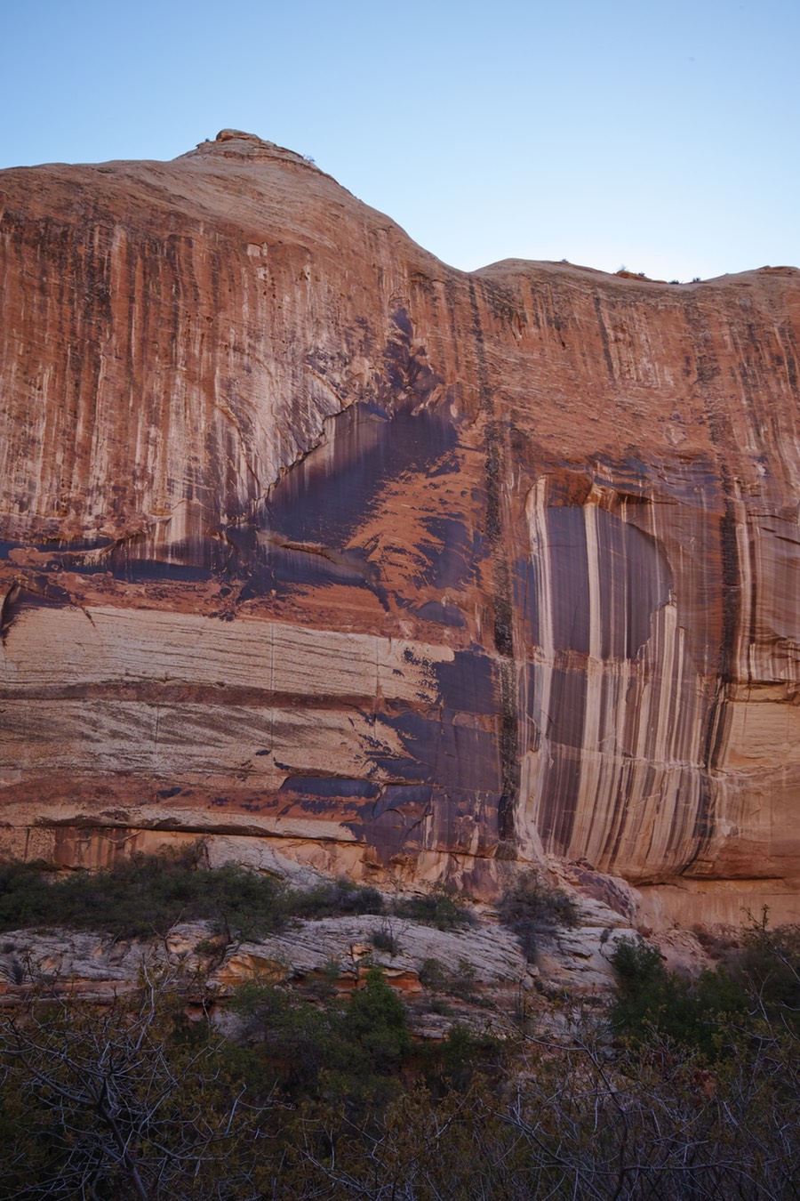
The Navajo sandstone cliffs around here are spectacular.
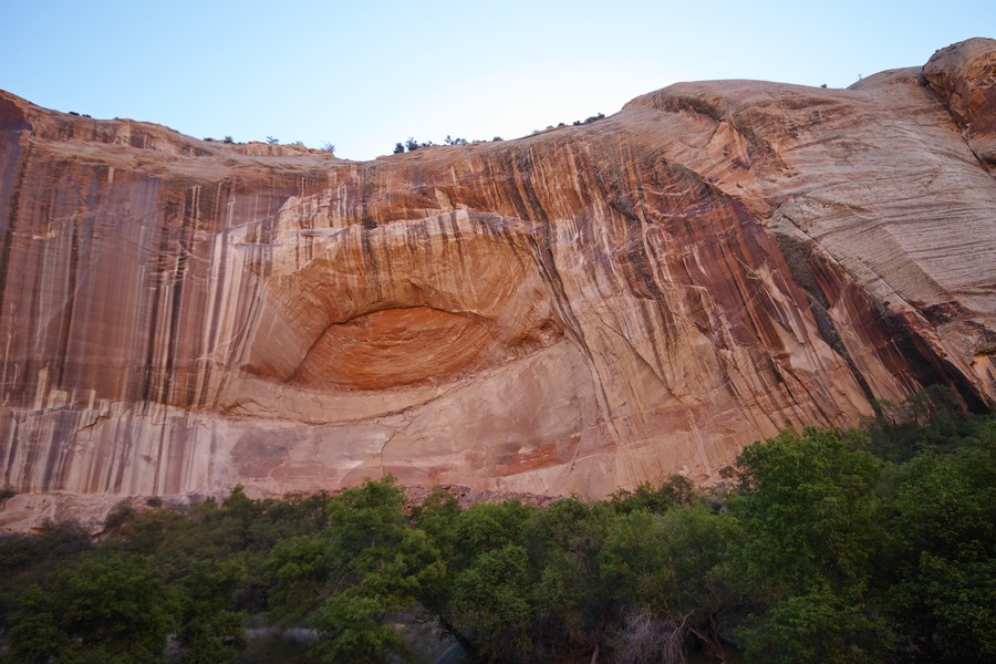
But of course, the highlight of this hike is the falls. This is a 130’ drop into a beautiful pool.
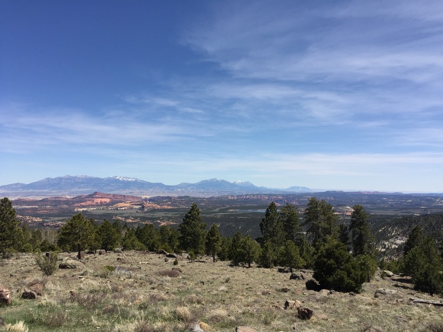
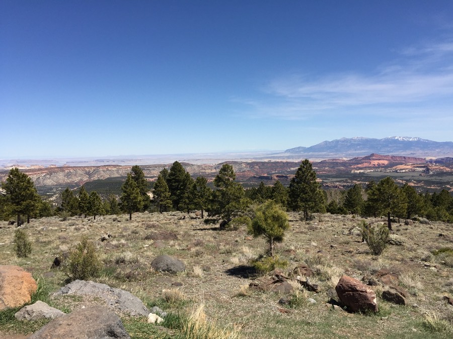
Utah Trip–Drive to Capitol Reef
We stopped a couple times on our drive from Escalante to Capitol Reef. These are just iPhone overlook shots (Boulder, UT; Dixie National Forest). It’s spectacular scenery in all directions! There was quite a bit of snow in the pass we drove through.
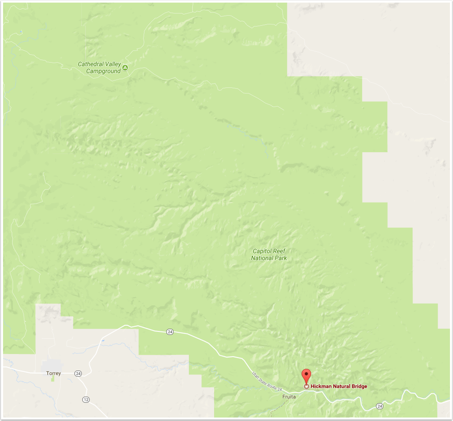
Utah Trip–Saturday Afternoon, Capitol Reef Hickman Bridge
After a nice drive across a bit of Utah, we got a place in Torrey and then headed to the Capitol Reef visitor center. Wow! The place was packed. Capitol Reef used to be a ‘barely visited’ National Park, but it’s skyrocketing in popularity. We asked one of the rangers there about the road to Cathedral Valley—it’s a really long (25-30 mile) drive in, and there are times where the road can be impassable if you don’t have a 4wd vehicle. He commented that the road had been recently graded, and we shouldn’t have any issues getting there. So that was on the schedule for a Sunday sunrise shoot. We decided to make a quick trip down the road to Hickman’s Bridge.
The hike was probably a mile and a half with some modest elevation (500 feet). We obviously weren’t hitting the bridge in the best light.
Utah Trip–Sunday Morning, Capitol Reef Cathedral Valley
Up before the crack of dawn (4 am), leaving our motel for a drive to Cathedral Valley. From Rt. 24, the unpaved road is a twisty route of 17 miles to the Temple of the Sun and Temple of the Moon. These are the two monoliths that we’re hoping to shoot at sunrise. We had a bit of difficulty finding the turn off in the dark (no surprise), and then you should stay right (don’t take a quick left—there some camping right by the road). Rick did the driving, which was just fine with me. About 3/4 into the trip Rick pulled over and we had a discussion about turning back. There were some reasonable clouds in the sky, and we weren’t sure whether we’d get a sunrise. The decision was to push on—I had never been out here at we were already pretty far into the trip.
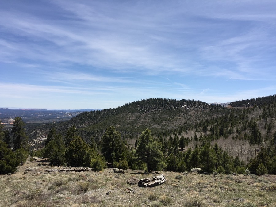
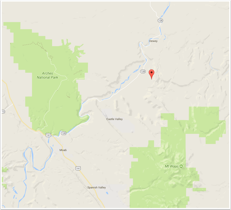
Utah Trip–Sunday Afternoon, Fisher Towers + Kendall
So, Rick and I rolled into Moab and met our fellow Sigma photographer, Kendall. It was great to see Kendall again—it’s probably been six or seven years, which is much too long. We got settled into our hotel, told some stories, and then decided to head out to Fisher Towers. Fisher Towers is north of Moab off of Rt. 128, which wanders along the Colorado river. Arches is due west, and the La Sals are south. This was my first time to the area. We had partly cloudy skies to start out with...
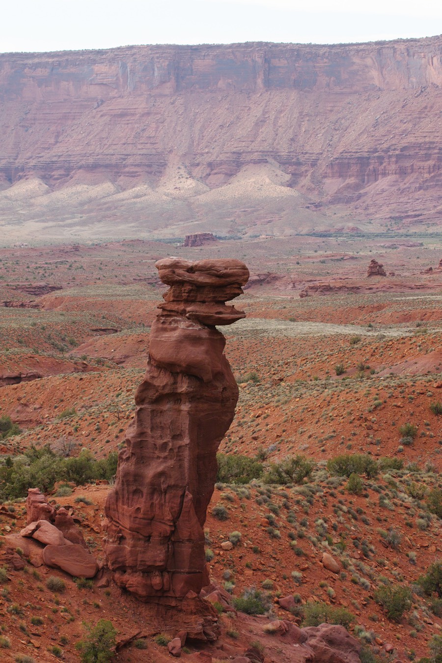
It’s like a sentinel! The is shooting west, and the Colorado is tucked in the valley there. Pretty damn impressive erosion.
Eventually you must get complacent having all these amazing rock cliffs around. But not so much if you live in Wisconsin.
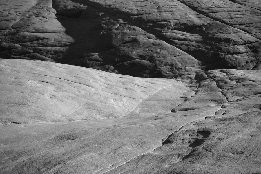
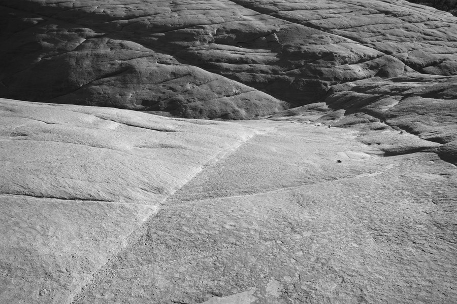
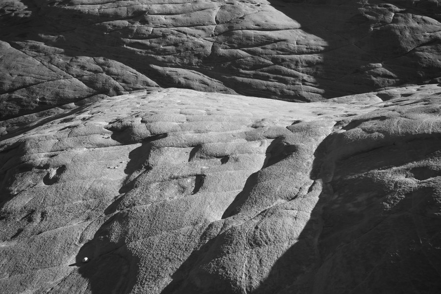
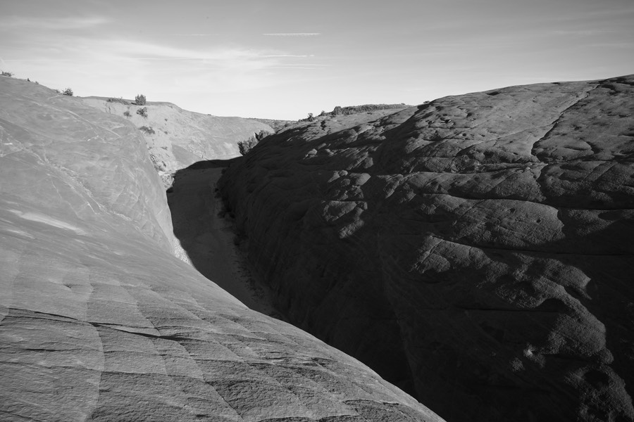
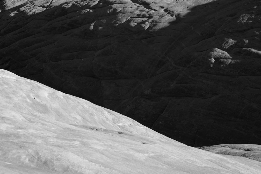
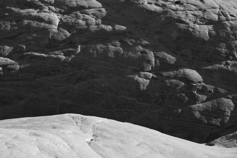
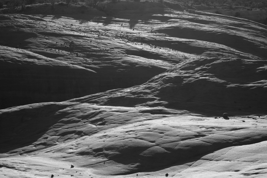
Utah Trip–Monday Morning, Klondike/Arches
We were a bit lazy Monday; no need to get out at the crack of dawn to do magnificent sunrise stuff, mainly because Arches main road is closed between 7 pm and 7 am for construction during this year. It sucks for photographers! Kendall brought his wife’s Jeep Cherokee; a sweet older ride. We decided to do some off roading to get up to the back side of the far northwest corner of Arches (Klondike), to hike and explore around there.
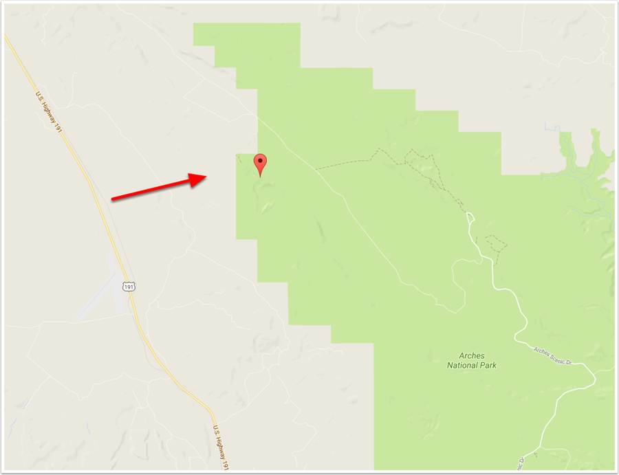
The off roading was super fun—although we would have been much better served with mountain bikes if we had wanted to make great time. This place is apparently a mecca for mountain bikers, with lots of great trails and some fantastic scenery. If you look at the below map, you’ll see all the white stuff to the left side—that’s what we Jeeped up. There were some really well marked trails, and as I mentioned, we had a lot of fun. The places where the arrows are is where we hiked to, and where our shots our from. What we didn’t realize before we left is that there’s no really good way to get down into the sandstone (the bluffs)—that stuff we were perched on is a couple hundred feet above the floor (at least), and we didn’t see any easy way down (by easy, I mean that we would live to tell about it).
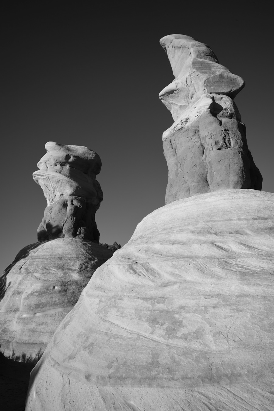
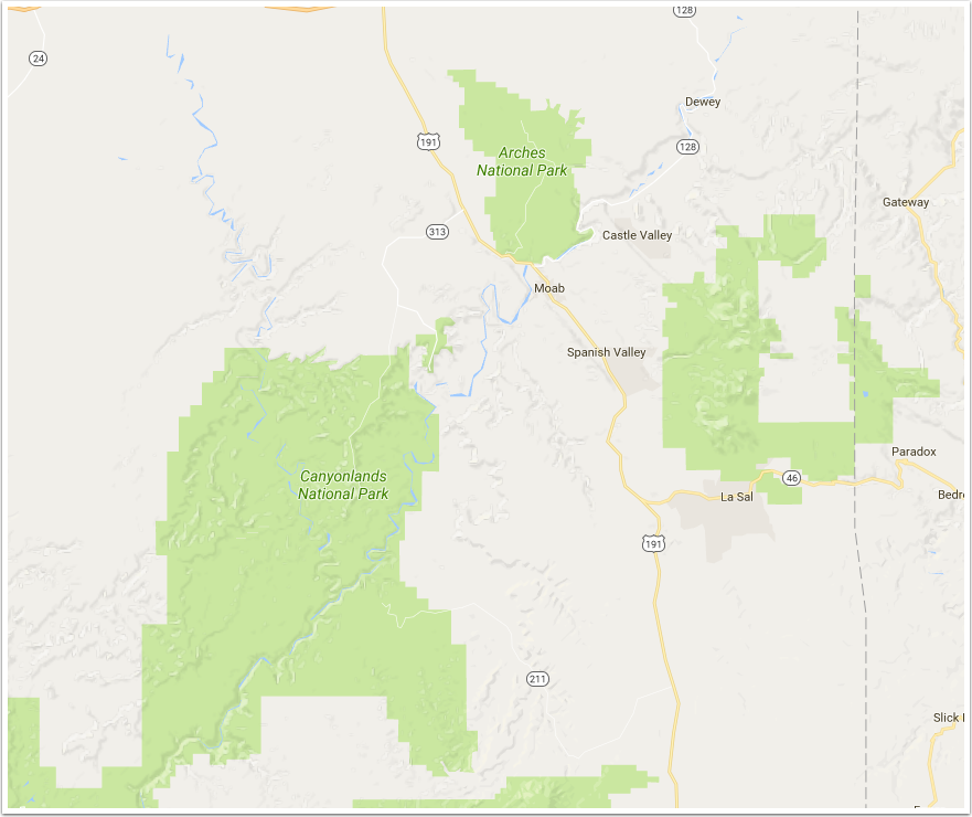
Utah Trip–Monday Afternoon, Canyonlands
Moab is really a great central location if you like doing this rock stuff. Just around the corner to the southwest is Canyonlands National Park—a huge expanse (much of it remote), with two major rivers (the Green and Colorado) running through it. Even though it’s just miles from Arches, it’s really quite a bit different. Much more massive in scale, and a plateau ‘grasslands’ area that drops down 1000+ feet into the canyon floor. This was my first time in the park, and I will say that I loved it. Remember, we were dealing with crappy overcast light and 100 mph winds (OK, maybe not that bad, but it was really windy).
Getting into the park, we pulled over at an overpass and shot these two monuments. I’m sure that they have names, but I’m too lazy to look them up. The sky was certainly interesting with the cloud formations, and these suckers were moving...